November 2026 · Cool Walk
How Cool Walk was built
Cool Walk started because I take daily walks, and it occurred to me there are probably some routes that are more shaded than others. This project actually started around April 2026, back when the best models were something like Opus 4.8. I just asked the model, "Hey, can we figure out where the shade is?" and it found out there are public databases of foliage.
Within an hour or two I had something that kind of worked: an app that would show the foliage, and you could even plan a route that was optimized for the shade. Almost done, I thought.
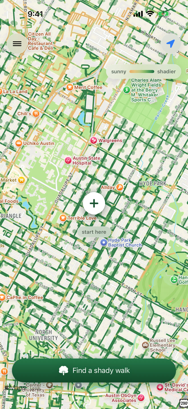
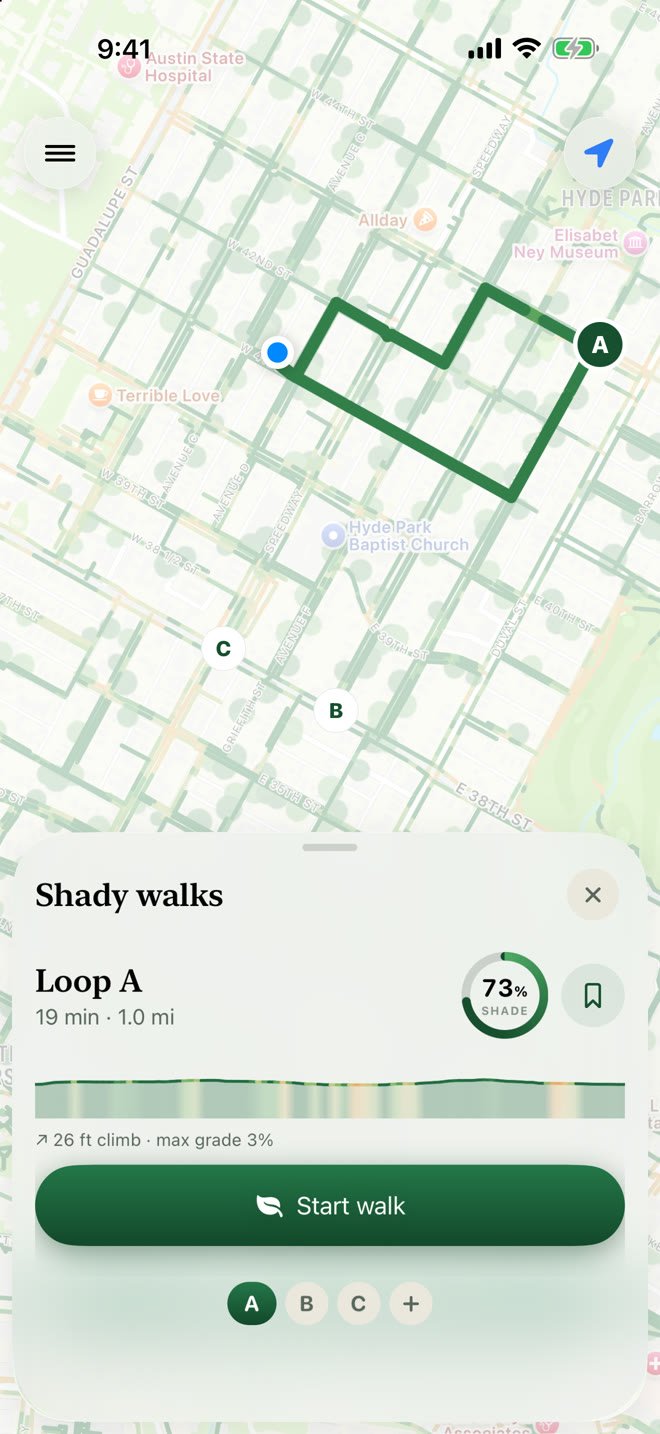
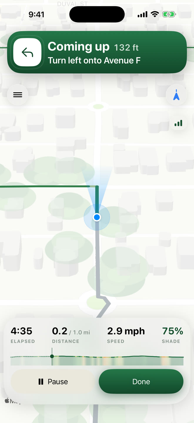
Well, there were problems with it. First off, there are a couple of different databases that cover the continental US for shade. And second, you can't just send all the data at once, because you need different resolutions for different zoom levels. So I had it go off and use a spot instance on EC2 to create a massive tile database of all the shade. That way you can actually zoom out all the way to the whole US and zoom back in, and the performance is pretty good.
Part of that database is also the routing and where the roads are, which led to another huge problem. When I first started testing it, it would route me over busy highways, or send me into a cul-de-sac only to double back.
I kept working on this on and off for months, along with the turn-by-turn directions. It turns out that getting a phone to have any idea where you are in space while you're walking is incredibly tricky. There are research papers about this.
Eventually I had to create a harness where it would take a walk using fake, bad GPS data and then iteratively try to improve itself. It would use the pedometer to figure out the likely pace, and the compass to figure out the heading.
I had it find 100 different points in the continental US and see if it could route a 45-minute walk that's generally a loop, without doubling back or crossing itself.
And still, it was pretty crappy. The routing would get confused, the map and the GPS would be flaky, and it wouldn't announce turns at the right time.
So when Opus 5.5 came out, I said, on a lark, let's just rewrite this whole thing: take the existing app, duplicate all the features, and rewrite it from scratch. And suddenly I had by far the best version I'd ever had. The GPS walking worked well, and the map routing was great. There were still bugs, but over the next couple of weeks I managed to iron them out.
Cool Walk is a free iPhone app that plans walking routes along streets with more trees, anywhere in the lower 48 states.
See Cool Walk